Tamriel Data:Regions
The UESPWiki – Your source for The Elder Scrolls since 1995
< Mod / Morrowind: Tamriel Data
The regions listed below are technically defined by Tamriel Data, though their individual pages are under the corresponding mod that adds playable content for that region. They are defined by Data mainly so that region records are not spread throughout section files during development and so that they can easily be changed.
Cyrodiil Regions[edit]
Colovia[edit]
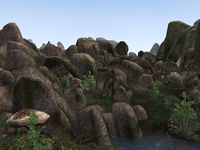
- Brennan Bluffs — An arid, rocky region of northwestern Colovia that stretches from the Strident Coast to the Brena River.
- Dasek Marsh — A long, narrow region of southern Colovia that runs the length of the Strid River.
- Stirk Isle — A large tropical island located within the Abecean Sea, off the western coast of Colovia.
- Strident Coast
Other[edit]
- Abecean Sea — A large sea that lies between the provinces of Cyrodiil, Hammerfell, and the Summerset Isles.
Morrowind Regions[edit]
Telvannis District[edit]
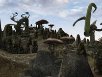
- Boethiah's Spine — A large mountainous region in Telvannis, Morrowind, featuring rugged rocks twisted in strange shapes by erosion.
- Dagon Urul — A rocky and unpleasant coastal region in the Telvannis District of Morrowind.
- Amurbal Peninsula — A long promontory in the Molagreahd that reaches out west from the mainland into the Sea of Ghosts.
- Neidweisra Peninsula — A huge piece of land that juts out northwest from the eastern arm of the mainland of Morrowind.
- Scath Anud
- Sunad Mora — A region in the district of Telvannis, Morrowind, consisting of rolling hills and fertile pastures.
- Balachen Corridor — An area of Boethiah's Spine east of Tel Oren and west of Ranyon-ruhn.
- Dolmolag Peninsula — A vast promontory in the Boethiah's Spine that projects into the Sea of Ghosts.
- Molkadh Mountains — A rugged part of the Boethiah's Spine region to the northeast of Ranyon-ruhn.
- Nebet Peninsula — A promontory east of Llothanis and Nebet Bay.
- Ouadavohr — An area of low-lying ground in the larger Sunad Mora region.
- Telvanni Isles — The northeasternmost islands in Tamriel, located in the Telvannis District of Morrowind.
Mournhold District[edit]
- Aanthirin — A lush orange-green region in the Mournhold District of Morrowind.
- Alt Orethan — The rocky scrubland between the city of Almalexia and the Lan Orethan forest.
- Lan Orethan — A lush lowland forest valley, set on the banks of the serene Lan Orethan river.
- Mephalan Vales — A humid and rocky region that extends the Boethiah's Spine southward.
- Molag Ruhn — A region of rich pastures in the Mournhold District of Morrowind.
- Nedothril — A coastal grassland region in the Mournhold District of Morrowind.
- Sacred Lands — The peaceful coastal region surrounding Necrom.
- Sundered Scar — An area of marshland along the southern coastline of the Inner Sea.
Narsis District[edit]
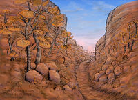
- Coronati Basin — A region in the Narsis District of Morrowind, with a distinct yellow-orange landscape.
- Othreleth Woods — An autumn-like region in the Narsis District of Morrowind.
- Shipal-Shin — A reddish region of cliffs in the Narsis District of Morrowind.
Velothis District[edit]
- Armun Ashlands — A region of dust and ash in the Velothis District of Morrowind.
- Clambering Moor — A region in the Velothis District of Morrowind.
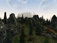
- Great Valley — Steep glacial valley region in the Velothis District of Morrowind, covering the northwestern border of Morrowind with Skyrim.
- Grey Meadows — An ash swamp region in the Velothis District of Morrowind.
- Julan-Shar — A tundra region in the Velothis District of Morrowind.
- Roth Roryn — A region of rocky canyons in the Velothis District of Morrowind.
- Velothi Mountains — A mountainous region in the Velothis District of Morrowind, forming a natural border with much of Cyrodiil and Skyrim.
Deshaan District[edit]
- Amber Forest — A wooded region in the Mournhold District of Morrowind, poisoned by the salts of the Deshaan Plains.
- Arnesian Jungle — A region in the Deshaan District of Morrowind, with terrain similar to the bordering Black Marsh.
- Dejasyte
- Deshaan Plains — A flat and fertile river valley region in the Deshaan District of Morrowind.
- Mudflats — A region in the Deshaan District of Morrowind.
- Shalimar Highlands — An intermediate region between the Deshaan Plains and Arnesian Jungle in the Dres District of Morrowind.
Bodies of Water[edit]
- Padomaic Ocean — The vast ocean that borders the eastern coast of mainland Morrowind and wraps around much of Tamriel.
- Sea of Ghosts — The cold sea that borders all the northern coasts of Tamriel and surrounds the Telvanni Isles.
Skyrim Regions[edit]
Released[edit]
- Druadach Highlands
- Lorchwuir Heath — A large open spaces where wild animals and other beasts roam.
- Midkarth
- Vorndgad Forest
Planned[edit]
- Grey Plains — (Formerly called Falkheim)
- Sundered Hills — (Only four cells are currently accessible)
- Kilkreath Mountains
- Solitude Forest
- Valstaag Highlands
Notes[edit]
- Ridgelands and Shambalun Veil are also defined by Tamriel Data but not expected to ever be used. Ridgelands was the name for an area occupying much of the Valstaag Highlands, Shambalun Veil was a proposed replacement for the deprecated Valley of Mephala.

