Oblivion:Dragonclaw Rock
The UESPWiki – Your source for The Elder Scrolls since 1995
|
|||
|---|---|---|---|
| Console Location Code(s) | |||
| DragonClawRockExterior | |||
| Region | |||
| Jerall Mountains | |||
| Location | |||
| Northeast of Bruma, southeast of Serpent's Trail | |||
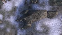
Dragonclaw Rock is an unusual rock formation northeast of Bruma (quest-related).
The formation was used as a waypoint by Akaviri invaders to find the path to their hidden base, Pale Pass. The path leads from the formation due west to the Sentinel, then continues due north to the Serpent's Trail. Dragonclaw Rock is used as a waypoint once again in the quest Lifting the Vale, where it is referenced in the Pale Pass Map and messenger's diary given to you by Countess Carvain.
Although your map indicates the Silver Road ends at Dragonclaw Rock, an unmarked road continues eastward (passing just south of Dragonclaw Rock).
Related Quests[edit]
- Lifting the Vale: Countess Narina Carvain wants you to find the Draconian Madstone.
Notes[edit]
- Dragonclaw Rock appears in ESO as Fort Dragonclaw.
- Dragonclaw Rock also appears in Legends.
