File:User-MGPlatinium-MGPlatiniumNirn.jpg
The UESPWiki – Your source for The Elder Scrolls since 1995

Size of this preview: 800 × 399 pixels. Other resolutions: 1,024 × 511 pixels | 3,299 × 1,646 pixels.
Original file (3,299 × 1,646 pixels, file size: 1.7 MB, MIME type: image/jpeg)
Summary[edit]
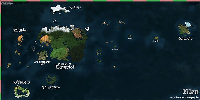
Finally, a full map of Nirn!
Licensing:[edit]
 |
This image was created for use on UESP using components taken from the Elder Scrolls series of video games or from websites created and owned by Bethesda Softworks. The copyright for the components is held by Bethesda Softworks while the copyright for this particular composition is held by UESP. It is available for use under the same Attribution-ShareAlike 2.5 License as our text content. For further details, see our copyright policy. |  |
File history
Click on a date/time to view the file as it appeared at that time.
| Date/Time | Thumbnail | Dimensions | User | Comment | |
|---|---|---|---|---|---|
| current | 02:58, 7 January 2012 | | 3,299 × 1,646 (1.7 MB) | MGPlatinium (talk | contribs) | 1.1 Changes: -Improved location of Pyandonea and Aldmeris -Map height now 7500km instead of 7000 -Added many more island for looks -Removed "4E 202" from the corner, removing any implication of date. -Smoothed out the ocean -Made Thras truthful to its des |
| 05:05, 6 January 2012 | 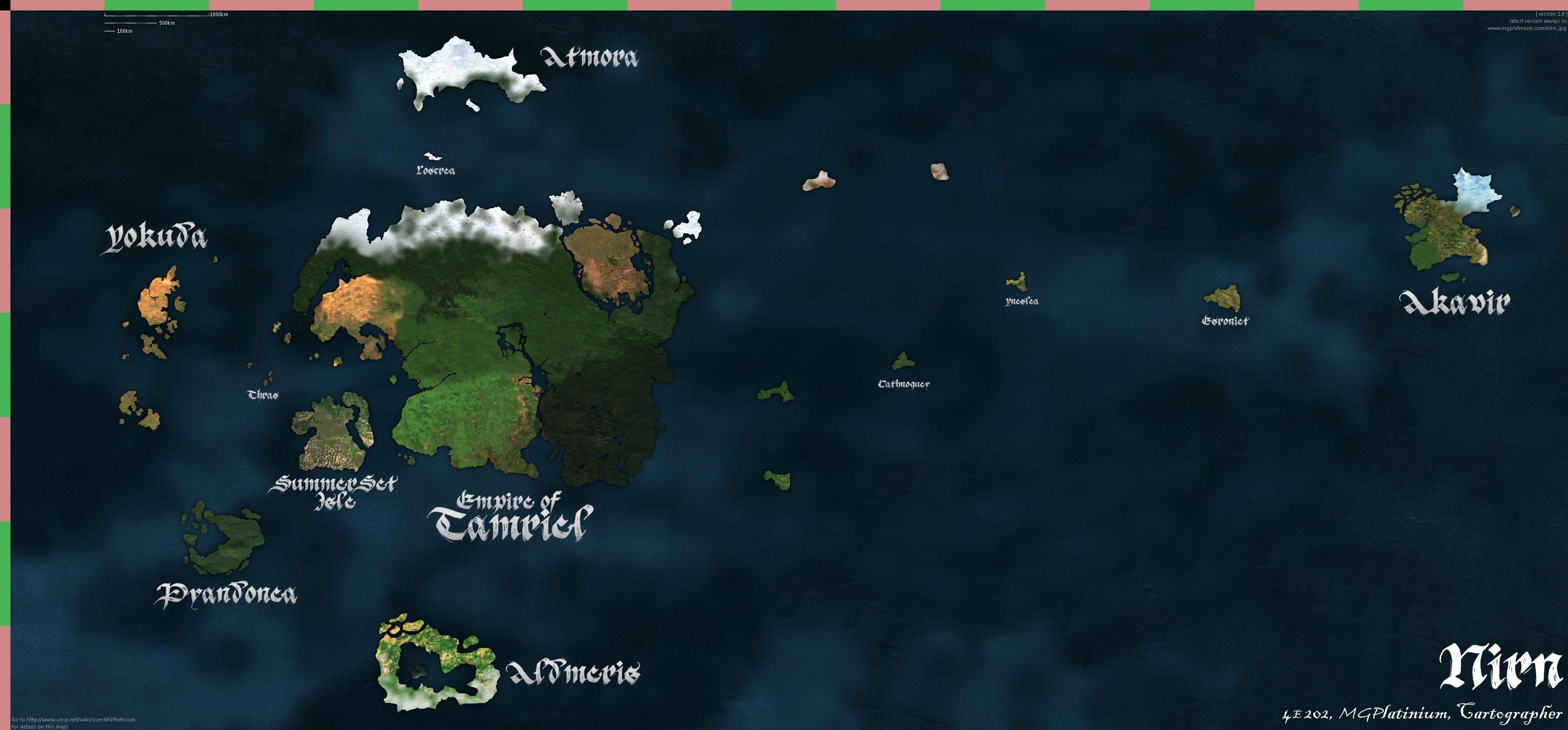 | 3,299 × 1,536 (1.84 MB) | MGPlatinium (talk | contribs) | Put a little note in the bottom-left. Needless to say, all landmasses that have never been shown were entirely made by me. | |
| 04:57, 6 January 2012 |  | 3,299 × 1,536 (1.83 MB) | MGPlatinium (talk | contribs) | Finally, a full map of Nirn! |
- You cannot overwrite this file.
File usage
The following page links to this file: